25 October 2022

NEW! Online Training Platform Built for licensed professionals in New York (PE and PG)

Our new online training platform allows you to gain technical insights while earning CEUs toward your professional licensure.  

Approved by the NY SED, you can receive your CEU certificate immediately following completion of any of our (110+) technical on-demand webinars or online courses.  Automated participation monitoring and confirmation of your PG licensure is required. 

“The course catalog allows me to choose a topic that relates to my current work assignments in addition to satisfying CE requirements for PGs in New York.”  -Adam Norvelle, P.G.

CLICK HERE 

for more information and discounted access to 160+ webinars and online training.


https://midwestgeo.com/nype.php


for more information and discounted access to 160+ webinars and online training.


20 October 2022

American Geophysical Union Annual Meeting - Chicago

Midwest GeoSciences Group will be a featured exhibitor at the Annual AGU Meeting in Chicago, December 11-16, 2022.

With the recent release of the new SOIL CLASSIFICATION EXAM KIT coupled with an AGU presentation summarizing the Environmental Sequence Stratrigraphy of a complex site in Illinois, AGU has chosen Midwest GeoSciences Group as a featured exhibitor.

Thank you to those at AGU for your kind gesture.


ABSRACT

Unraveling the Complexities of a Glacial Sequence at a site in Tazewell County, Illinois for a Hydrogeologic Project: 
Stepwise-Procedures for Applying Environmental Sequence Stratigraphy.

KELLEHER, Daniel, L., Midwest GeoSciences Group, 1950 Greyhound Pass, Suite 18, Carmel IN, 46033; dan@midwestgeo.com; KEMMIS, Tim, J., Midwest GeoSciences Group; tim@midwestgeo.com; 

Understanding the past depositional processes was the key factor for unraveling the complexities during a hydrogeologic project in Tazewell, County, Illinois.  The sequence of sediments have multiple origins ranging from stream deposits, subglacial tills to thick intervals of proglacial outwash from Wisconsinan, Illinoian, and pre-Illinoian glacial periods.

Ten years of drilling from past projects yielded varying hypotheses for both ground water movement and the glacial sedimentary sequence.  Each progressive project approached the subsurface differently as reflected in the boring logs, the geologic cross sections, and the resulting potentiometric surface maps and vertical flow nets.

Eventually, it was confirmed that applying fundamental depositional principles and secondary weathering observations proved important because it provided the context for understanding the variability and uniformity in soils, physical properties, and groundwater conditions that were essential for confident ground water monitoring and engineering design.   

Although the process for defining and mapping stratigraphy is a basic premise of geologic principles, the United States Environmental Protection Agency published a 2017 report about the need for understanding basic subsurface characterization titled Environmental Sequence Stratigraphy.   The subsurface characterization work in Tazewell County followed the three published phases for defining and mapping stratigraphy, but the process unraveled the complex stratigraphic sequence derived from different depositional environments coupled with yielding a meaningful geologic framework that has proved valuable to the County and subsequent regional mapping by various agencies.


03 October 2022

Smart Hole Stratigraphy in Geneva, Illinois - 2022 WORKSHOP


2-DAY WORKSHOP


Title:

Managing the Complexities and Uncertainties of Soil Sequences:
For Hydrogeological and Geotechnical Investigations – Principles and Field Techniques

Date:

Tuesday and Wednesday, September 20-21, 2022

Location:

Kane County Cougars Baseball Stadium – Conference Facility and Owners Suite with a private offsite drilling location.

Instructors:

•  Dan Kelleher, PG, CIPM, Hydrogeologist and Principal, Midwest GeoSciences Group

• David Hart, PG, PhD, Program Leader, Hydrogeologist, Wisconsin Geological and
   Natural History Survey

• Tim Kemmis, PG, PhD, Hydrogeologist, Midwest GeoSciences Group

What did we find in this soil boring?
Why was it so exquisite?

The course instructors have drilled numerous continuous soil borings in the region for the past 20 years. We've found a predictable consistency in the geologic framework beneath numerous cities and towns where these stratigraphic formations and members are mapped.

However recently, we've discovered an entirely new and older sedimentary sequence that has not been regionally mapped. The buried sequence allows an unmatched opportunity to teach both the principles of depositional environments and secondary weathering in northeastern Illinois where we didn't know previously existed.

[Not only did the new sedimentary sequence get us excited, but we recognize how it can applied to many different glacial deposits and sedimentary sequences far beyond the local geologic framework]

Wisconsin-Age Sediments
The drilling location for this course in Geneva, Illinois is within the mapped area of the Yorkville Member of the Lemont Formation near the DuPage - Kane County border. Four facies of the Yorkville Member are expected to be present in the boring: an ice-marginal facies and three subglacial facies. Below the Yorkville Member is the Batestown Member which can be variable in depositional environments and the resulting sedimentary properties.

Sorted outwash sediments of the Henry Formation and/or the Equality Formation may occur within the Yorkville Member or Batestown Member. One of the most interesting discoveries is when sorted sediments are present and then to recognize its stratigraphic position and context. Without stratigraphic control/context, understanding the relationships between borings (where the sorted sediments are present) is virtually 'mission impossible'. But with stratigraphic context, it gives tremendous certainty and we can correlate buried sands without much question.

Pre-Wisconsin-Age Sediments
This boring confirmed a buried "pocket" of pre-Wisconsin-Age sediments in the area. We ran Carbon-14 dating tests of the buried topsoil and confirmed it was pre-Wisconsin-Age and we assigned it to the Farmdale GeoSol.

Under the buried A-Horizon topsoil is a thick oxidized and unleached (OU) weathering zone. The sedimentary sequence included both subglacial and resedimented diamictons (glacial till) along with intervals of sorted sediments.

Not only is the buried "pocket" geologically interesting and an important discovery for regional mapping, but this single soil borings revealed the spectrum of attributes that can be applied to most glacial sequences anywhere.

In this one boring, we
  • observed each of the major glacial depositional environments
  • observed each of the major outwash depositional environment
  • built a stratigraphic model based on depositional history
  • gave geologic context to buried sand and gravel intervals
  • and determined if they tend to be isolated lenses
  • and determined if they tend to be laterally continuous
  • observed two weathering zone profiles
  • observed two A-Horizon Soils, one modern and one ancient
  • learned how ground water moves through the holistic hydrogeologic system.

This was a historic opportunity to more than witness a geologic discovery. This iwas historic opportunity to learn about applying geologic principles to professional work. There are not many chances like this where we can synthesize the geology in a way it can be applied to so many different other areas.

14 May 2022

HISTORY MAKING DAYS (and nights)

We're in the midst of history-making days (and nights).

May 15, 2022 offers 85 minutes of a total lunar eclipse that begins at 11:29AM ET.  All that's required to witness the event is (1) clear skies, and (2) go outside and look.  

Midwest GeoSciences Group will join science-minded friends in Carmel, Indiana to watch the eclipse, but the real exciting topic of conversation will be these history making days where astrophysicists have captured the imagery of the massive black hole at the center of our own galaxy, the Milky Way Galaxy.


October 6, 2020 marked the Nobel Prize Award for confirming the existence of the supermassive black hole.  More than 300 people from about 90 institutions searched collectively for this confirmation using radio telescopes.  

The imagery for the black hole was released on May 12, 2022 at multiple press conferences simultaneously world-wide.  

These images alone do not tell the remarkable nature of these phenomenon.  

Scale of time and distance are nearly unfathomable.  We as geoscientists can appreciate how computer modeling is used to unravel the context of their size, distance, gravity, and spacetime.  May be we have it easy with stratigraphy, plate tectonics, and planetary progressions.  For astrophysicists, nature itself changes with the fabric of outer space. Right?  .... we can all appreciate the complexity of this phenomenon.

These are exciting times to live.  We are witnessing history every day with new research results about exoplanets, dark matter, blackholes, galaxy formation, quantum entanglement, particle physics and telescope technology.  

If you are working on an interesting project and would like to share it with us, we'd love to hear from you.    -Dan Kelleher

service ..at.. midwestgeo.com


13 May 2022

Why Environmental Sequence Stratigraphy?

Why Environmental Sequence Stratigraphy?

May be first, let's recall it’s derivative, Sequence Stratigraphy.

In the most basic terms, Sequence Stratigraphy is a study of sedimentary deposits with respect to depositional environments and changes in sea level, sediment supply, and sediment-storage area through time.

Sequence Stratigraphy is the means to understand the subsurface architecture of marine sediments on the basis of understanding how depositional environments (and the resulting sediments) shift and change as sea level rises and falls.

Environmental Sequence Stratigraphy is a subsurface characterization approach applied to hydrogeologic and environmental projects based on understanding the geology. This approach allows us to understand the architecture of the sedimentary succession beneath our sites; that is, recognition not only of coarse- and fine-grained sediments in the succession, but their geometries, continuity, variability, and uniformity.

Isn’t the name of the game: understanding subsurface relationships !?  It's more than just mapping a secondary attribute such as soil classification, permeabilities, or contaminant occurrence.  Understanding subsurface relationship relies fully discerning the SOLE INDEPENDENT VARIABLE (i.e. depositional processes).  

So again, why Environmental Sequence Stratigraphy?   Call it anything you want.  Midwest GeoSciences Group has called it the “Sedimentary Stratigraphic Approach”, “Holistic Stratigraphy”, and “Holistic Hydrogeology” and we’ve even trademarked “Taking the Mystery Out of the Subsurface” along with creating an online training experience to do it.  

In the end, it’s the job we are hired to do as geoscience professionals: take the mystery out of the subsurface.


12 March 2022

Proud partner of the CARMEL MARATHON.

Midwest GeoSciences Group is a proud partner of the CARMEL MARATHON.

For the fifth year in a row, we are partnering with the weekend-long marathon race experience.  It's a rewarding way for Midwest GeoSciences Group to begin the summer with a tremendous fitness boost, along with expressing support for both the city, friends, and family members. 

Carmel is recognized nationally for being a bike-friendly city, and it ranks in the top 10 Bike Friendly Cities each year.  But the City of Carmel also promotes overall fitness and this showcase events generally launches the Spring and Summer into running events.


Good luck to Lori Kelleher!


11 March 2022

GROUND WATER is the focus of World Water Day, this year.

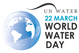
World Water Day, held on 22 March every year since 1993, focuses on the importance of freshwater.

World Water Day celebrates water and raises awareness of the 2.2 billion people living without access to safe water. It is about taking action to tackle the global water crisis. A core focus of World Water Day is to support the achievement of United Nations Sustainable Development Goal 6: water and sanitation for all by 2030.


GROUND WATER is the focus of World Water Day, this year. 

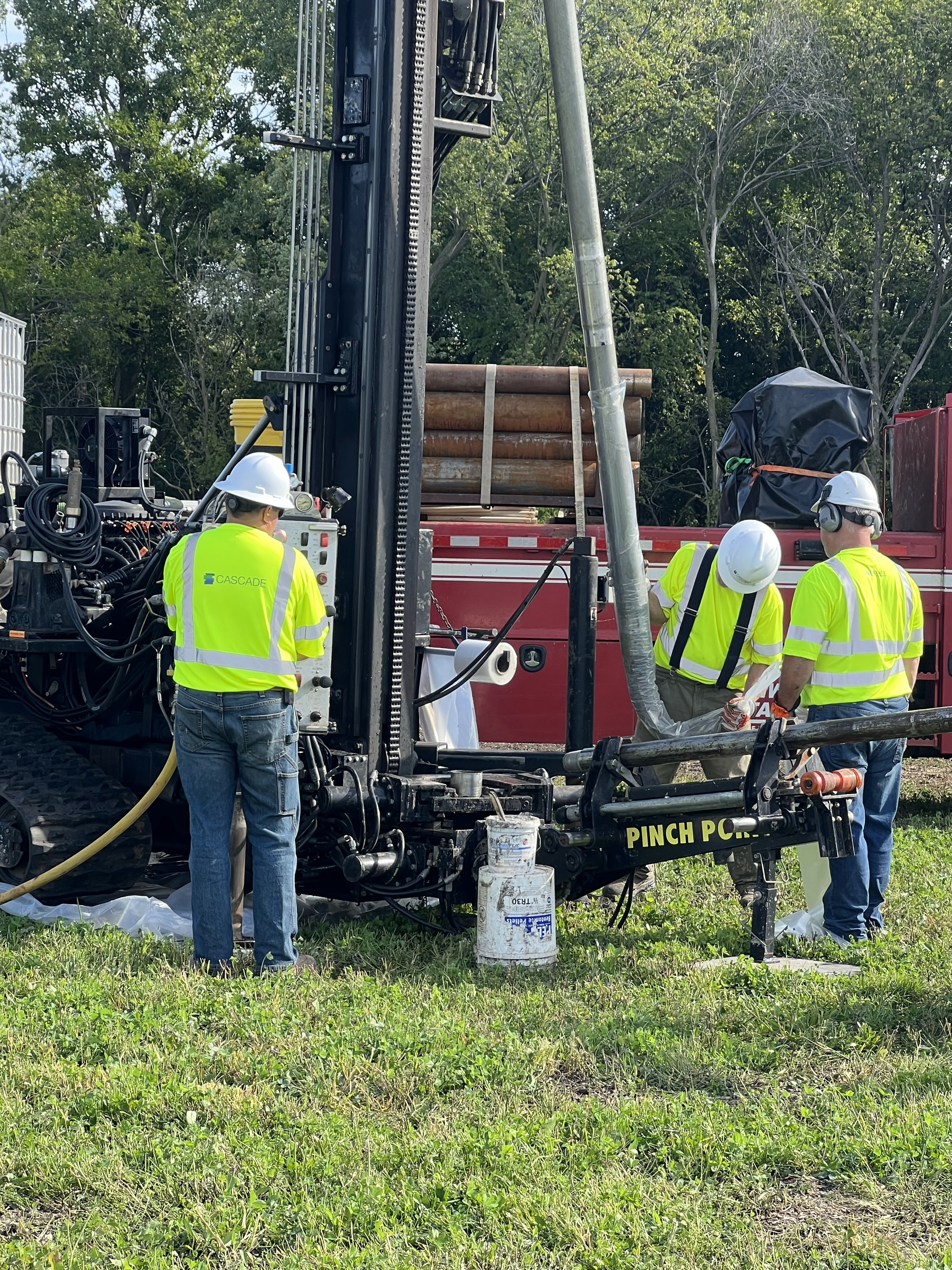
We Hydrogeologists appreciate how ground water is water is present in aquifers, which are geological formations of rocks, sands and gravels that hold substantial quantities of water. Ground water feeds springs, rivers, lakes and wetlands, and seeps into oceans. Ground water is recharged mainly from rain and snowfall infiltrating the ground. Ground water can be extracted to the surface by pumps and wells.

Life would not be possible without ground water. Most arid areas of the world depend entirely on groundwater. Ground water supplies a large proportion of the water we use for drinking, sanitation, food production and industrial processes.

It is also critically important to the healthy functioning of ecosystems, such as wetlands and rivers.

Midwest GeoSciences Group works to protect ground water resources from overexploitation and pollution since it can lead to depletion, extra-costs of processing it, and sometimes even preventing its use.

Exploring, protecting and sustainably using groundwater will be central to surviving and adapting to climate change and meeting the needs of a growing population.

This month, Midwest GeoSciences Group is teaching online courses that are a gigantic leap in understanding the nature of the geologic units that yield (aquifers) and protect (aquitards) groundwater.

The professionals that are hired to extract and clean up ground water search for best practices and it all starts with basic geologic principles.  It’s a noble mission for Midwest GeoSciences Group but it’s also noble for those professionals whose work will last beyond our lifetimes.